Hiking in Kyoto — Mount Inari, Daimonji, Kurama-Kibune and Mount Hiei
Kyoto: Fushimi Inari Shrine and Mount Inari Guided Tour
What is the best hike in Kyoto for a first-timer?
The Kurama-Kibune trail is the best single-day hike for most visitors — a well-marked 2.5-3 hour forest trail connecting two mountain villages, reachable directly by train from central Kyoto, with an onsen (hot spring) waiting at the end. Mount Inari's full summit loop (2-3 hours, free, open 24 hours) is the better choice if you want a hike combined with Kyoto's most iconic sight.
Kyoto has real hiking, not just temple walking
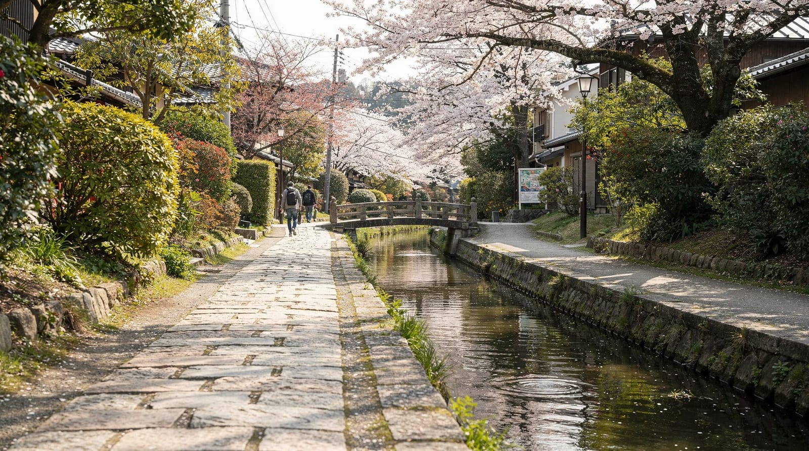
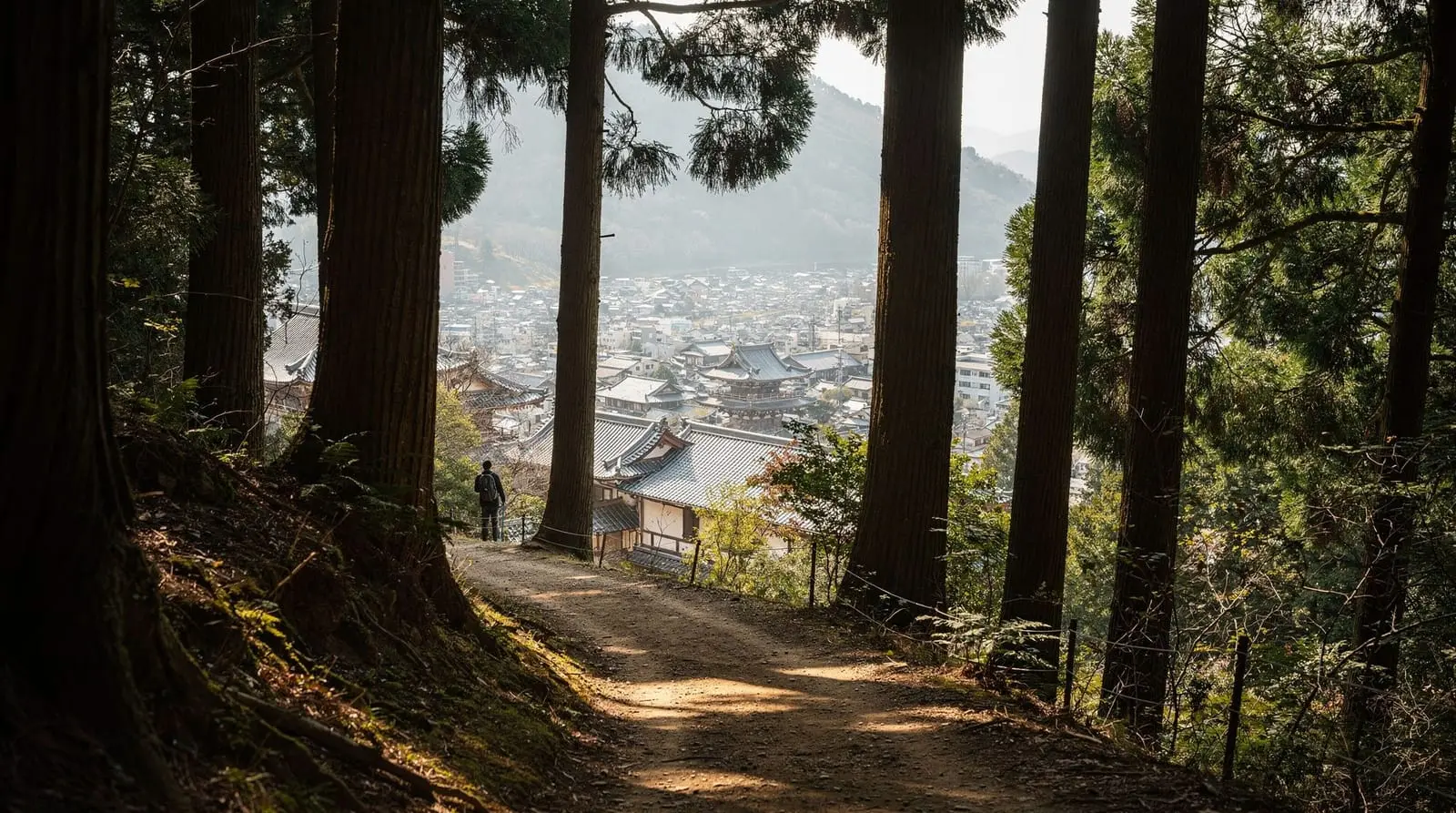
Most Kyoto itineraries are built around walking between temples, not hiking in any meaningful sense. But the hills ringing the city — the Higashiyama range to the east, the mountains north toward Kurama and Kibune, and Mount Hiei straddling the Kyoto-Shiga border — offer genuine forest trails, none requiring technical skill or gear, all reachable without a car. This guide covers four routes by difficulty and access: Mount Inari (the easiest and most famous), Daimonji (short but steep, with the city’s best free viewpoint), the Kurama-Kibune trail (the most complete forest hiking experience), and Mount Hiei (the longest and most demanding of the four).
| Trail | Time | Difficulty | Cost |
|---|---|---|---|
| Mount Inari (Fushimi Inari) | 2–3 hrs round trip | Easy–moderate | Free |
| Daimonji | 1–1.5 hrs round trip | Short, steep | Free |
| Kurama-Kibune | 2.5–3 hrs one-way | Moderate | Free (Kurama-dera entry optional) |
| Mount Hiei | 4–6 hrs full ascent | Demanding | Cable car or ~¥500–1,000 temple entry |
Mount Inari: hiking through 10,000 torii gates
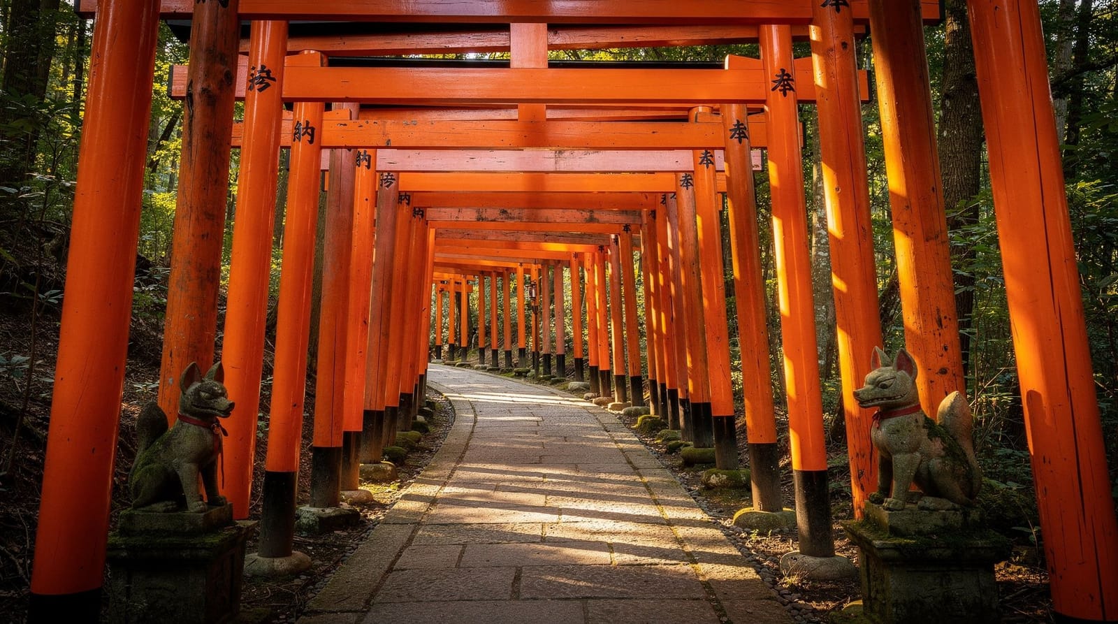
Fushimi Inari Taisha’s trail up Mount Inari is Kyoto’s most famous hike by a wide margin, and also its most crowded — a reasonable tradeoff, since it’s also free, open 24 hours, and the only hike on this list combined with a genuinely iconic sight. The full round trip covers roughly 4km and takes 2-3 hours at a moderate pace, climbing through the trail’s namesake sequence of vermilion torii gates, thinning out considerably past the Yotsutsuji intersection roughly a third of the way up.
Fushimi Inari Shrine and Mount Inari guided tourMost visitors turn around at Yotsutsuji, which offers a genuine view over southern Kyoto and takes 45-60 minutes round trip from the base — a reasonable stopping point if the full summit doesn’t interest you specifically. The summit itself (233m) adds real elevation but relatively modest additional visual reward, since the forest closes in and the view doesn’t improve meaningfully past Yotsutsuji. See the full Fushimi Inari guide for the complete route breakdown, history of the torii gates, and shrine details at the base.
For a genuinely quiet version of this hike, an early-morning start (before 8am) or an evening hike after dark are the two reliable options — several tours specifically run after sunset, when the lower Senbon Torii tunnel empties out almost entirely.
Fushimi Inari night hikeNight hiking here is genuinely atmospheric rather than just a crowd-avoidance tactic — sections of the trail have minimal lighting, and a guided night hike removes the safety concern of navigating unlit stone steps alone, while a headlamp and a hiking partner accomplish the same thing self-guided.
Daimonji: the short, steep hike with Kyoto’s best free view
Mount Daimonji, in the Higashiyama hills behind Ginkaku-ji, is the shortest hike on this list — roughly 1-1.5 hours round trip — but among the steepest per kilometer, climbing directly up a stone-and-dirt path to a clearing used each August 16th for the Daimonji bonfire, one of Kyoto’s five mountainside “Gozan no Okuribi” fire characters lit during the Obon festival. Outside the festival, the clearing offers one of the best free panoramic views over Kyoto, taking in the city grid, the distant hills, and on clear days a sense of just how enclosed in mountains the whole basin is.
The trailhead sits a short walk from Ginkaku-ji’s entrance, making this an easy add-on to a Higashiyama or Higashiyama walking tour day rather than a standalone outing — budget an extra hour beyond your temple time if you’re planning to fit it in. Sunset timing (starting the ascent 90 minutes to 2 hours before sunset) is the most rewarding approach, giving you daylight for the steep climb and a lit city view at the top, though descending afterward requires care on the unlit upper stretch — a headlamp or phone flashlight is genuinely useful.
Kurama-Kibune: the fullest forest hiking experience near Kyoto
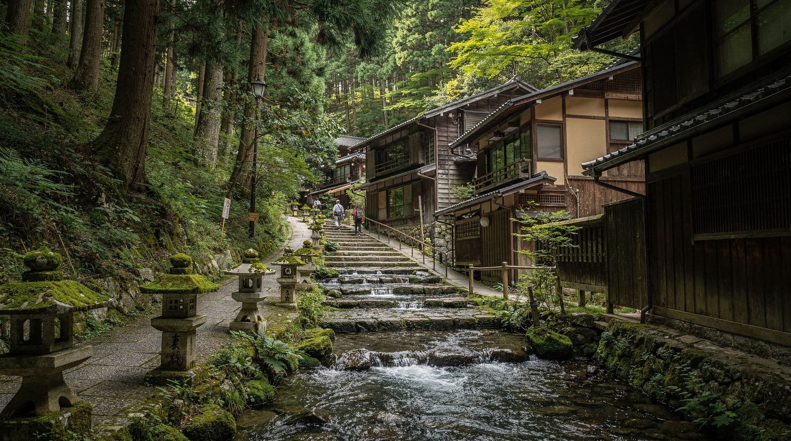
The Kurama-Kibune trail is the most complete forest hiking experience within easy reach of central Kyoto — a well-marked 2.5-3 hour trail connecting the mountain village of Kurama, home to Kurama-dera temple, with Kibune village on the other side of the ridge, known for its riverside restaurants built on platforms directly over the Kibune river in summer.
Access is straightforward: the Eizan Railway runs from Demachiyanagi Station (itself connected to central Kyoto via the Keihan Main Line) directly to Kurama Station, about 30 minutes total. The trail climbs from Kurama-dera’s grounds — itself worth visiting, with a cable car option for the temple’s lower section if you’d rather save your legs for the forest trail beyond it — over a forested ridge and down into Kibune. The full one-way hike covers roughly 4-5km through genuine forest, quieter and more remote-feeling than anything within the city itself.
Kibune village at the end is a legitimate reward, not just a trailhead: riverside dining platforms called kawadoko operate roughly May through September, serving meals with your feet nearly over the flowing river — a genuinely distinctive experience worth timing your hike around if you’re visiting in summer. From Kibune, a local bus or a further 30-minute walk connects to Kibuneguchi Station on the same Eizan line back toward the city. See the Kurama-Kibune destination guide for village-specific details, restaurant recommendations, and Kurama-dera’s own layout.
Mount Hiei: the longest and most demanding hike
Mount Hiei, straddling the border between Kyoto and neighboring Shiga prefecture, is the most demanding hike on this list — a full mountain, home to Enryaku-ji, one of Japan’s most historically significant Buddhist temple complexes, founded in 788 CE as the headquarters of the Tendai sect. A full hike to the summit and through Enryaku-ji’s grounds can run 4-6 hours depending on route and pace, considerably longer than any other option here.
For hikers not wanting the full day commitment, a cable car and ropeway combination climbs most of the mountain, allowing a hike of just the upper sections plus full access to Enryaku-ji’s grounds without the multi-hour ascent — a genuinely reasonable compromise if the temple complex, not the hike itself, is the priority.
Views from the summit take in Kyoto to the west and Lake Biwa, Japan’s largest lake, to the east — a genuinely different perspective from any other viewpoint on this list, since it’s the only one showing both sides of the mountain range dividing the two prefectures. See the Lake Biwa and Otsu destination guide for what’s on the other side of the mountain if you’re continuing that direction rather than returning to Kyoto.
Comparing the four hikes
Mount Inari is the easiest and most accessible, free, open 24 hours, and combined with Kyoto’s most photographed sight — but also the most crowded by a wide margin. Daimonji is the shortest and steepest, rewarding a modest time investment with the city’s best free panoramic view, and pairs naturally with a Higashiyama day. Kurama-Kibune is the fullest genuine forest hike, well-marked and moderate in difficulty, ending at a legitimately worthwhile village rather than just a trailhead. Mount Hiei is the longest and most historically significant, with a cable car option for those wanting the temple without the full ascent.
For a single day with limited hiking-specific time, Mount Inari or Daimonji fit more easily around a broader sightseeing itinerary. For a day built specifically around hiking, Kurama-Kibune or Mount Hiei are the better choices, since both are far enough from central Kyoto that combining them with several other sights in the same day isn’t realistic.
What to bring
Sturdy closed shoes with real tread matter across all four hikes — Daimonji and the upper stretches of Mount Inari involve loose stone and dirt that punishes flat-soled shoes, and Kurama-Kibune and Mount Hiei are genuine forest trails with roots and uneven ground.
Water matters especially on Kurama-Kibune and Mount Hiei, where purchase points are limited or nonexistent once you’re past the trailhead — Mount Inari and Daimonji, by contrast, have vending machines and small shops at several points along the route. A light rain layer is worth carrying regardless of forecast, given how quickly weather shifts in Kyoto’s surrounding hills. Cash covers Kurama-dera’s optional entry fee and Enryaku-ji’s admission (roughly ¥500-1,000), plus any snacks or drinks along the way.
Seasonal considerations
Autumn (November) is the most visually rewarding season for all four hikes, with foliage color peaking across the surrounding hills — also the most crowded weeks, particularly on Mount Inari and around Kurama-dera. Summer (June-August) is hot and humid enough that an early-morning start matters more here than anywhere else on this list, especially for the longer Kurama-Kibune and Mount Hiei routes; Kibune’s riverside dining platforms are also a specifically summer feature. Winter (December-February) is cold with occasional snow at Mount Hiei’s higher elevation, offering the quietest hiking conditions of the year but requiring more caution on icy sections near the summit.
Combining a hike with the rest of a Kyoto day
Mount Inari’s hike is most naturally combined with an early-morning start followed by a full day elsewhere, since it’s reachable and completable before most other sights open. Daimonji slots directly into a Higashiyama day given its proximity to Ginkaku-ji. Kurama-Kibune and Mount Hiei are substantial enough outings, once travel time is factored in, to function as their own half or full day — see the best day trips from Kyoto guide for how either fits alongside Kyoto’s other out-of-city options, and the avoiding crowds in Kyoto guide for broader timing strategy across the city.
Trail markers, navigation and phone signal
All four trails covered here are officially maintained and marked, though the quality of signage varies. Mount Inari’s trail is the best-marked of the four, with directional signs in English at every major junction, reflecting the volume of international visitors it receives. Daimonji has clear, if sparser, trail markers, and the route to the summit clearing is essentially a single path with no meaningful branch points to get wrong.
Kurama-Kibune is well-marked at the trailhead and at the ridge crossing, though signage thins out in the middle forested stretch — a downloaded offline map is a reasonable precaution given inconsistent phone signal in this more remote section. Mount Hiei’s marked trails are reliable near the cable car stations and temple complex but can be less consistent on the longer full-ascent routes, where a paper map or well-tested navigation app matters more than on any other trail here.
Combining two hikes in one trip
For hikers specifically prioritizing trail time over broader sightseeing, Daimonji and Mount Inari can realistically be combined in a single day given their modest individual time commitments (1-1.5 hours and 2-3 hours respectively) and their both being accessible without a long transfer from central Kyoto — an early Mount Inari hike followed by an afternoon Daimonji ascent timed for sunset is an ambitious but achievable day for a fit hiker. Kurama-Kibune and Mount Hiei are each substantial enough, once travel time to their trailheads is factored in, that combining either with another full hike in the same day isn’t realistic; treat each as its own dedicated outing.
Wildlife and practical trail safety
Kyoto’s surrounding hills host wild boar and, less commonly, sightings of Asian black bears in the more remote forested stretches around Mount Hiei and, occasionally, Kurama-Kibune, particularly in early morning or dusk hours during autumn when bears forage more actively before winter.
Encounters remain rare on the well-used trails covered here, but posted warning signs at some trailheads reflect a genuine, if low, possibility rather than decorative caution — making some noise while hiking (talking, or an attached bell) is a standard, low-effort precaution rather than an overreaction. Wild boar are more commonly encountered and generally avoid humans if given space; the practical advice is the same as with any wildlife encounter on these trails — don’t approach, don’t run, and back away slowly while giving the animal a clear path to retreat.
Frequently asked questions about hiking in Kyoto
Do I need hiking experience for trails around Kyoto?
No — none of the four trails covered here require technical hiking experience or specialized gear. Mount Inari and Daimonji are steep in sections but on well-maintained stone steps or clear dirt paths. Kurama-Kibune and Mount Hiei involve more sustained forest walking but stay on marked, well-used trails throughout. Reasonable fitness and proper shoes matter more than prior hiking experience.
Is the Fushimi Inari hike to the summit worth doing, or is Yotsutsuji enough?
For most visitors, Yotsutsuji (roughly a third of the way up, 45-60 minutes round trip) is enough — it offers a genuine view over southern Kyoto and marks where the crowds thin out dramatically. The summit adds another 1.5-2 hours round trip through progressively quieter, less visually distinct forest with smaller shrines, appealing mainly to travelers who specifically want to complete the full loop or who prefer a longer, quieter walk.
How do I get to the Kurama-Kibune trailhead?
Take the Eizan Railway from Demachiyanagi Station (itself reachable by the Keihan Main Line from central Kyoto) to Kurama Station — about 30 minutes total from downtown Kyoto. The trail starts near Kurama-dera temple, a short uphill walk from the station, and ends at Kibune village, from which a local bus or a further walk connects back to Kibuneguchi Station on the same Eizan Railway line.
Can I hike Daimonji at night to see the city view?
The trail is open, but hiking after dark without a headlamp is genuinely inadvisable given the uneven stone steps and lack of lighting on most of the route. Sunset timing — starting the ascent 90 minutes to 2 hours before sunset — gives you daylight for the climb and a lit-up city view without needing to descend in full darkness, which is the safer and more commonly recommended approach.
What should I bring on a Kyoto hike?
Sturdy closed shoes with real tread — none of these trails require mountaineering boots, but flat sandals or worn sneakers are a genuine liability on stone steps and loose forest paths. Water (there are limited or no purchase points on Kurama-Kibune and Mount Hiei once you’re past the trailhead), a light rain layer given Kyoto’s changeable weather, and cash for temple entry fees along some routes.
Are these hikes crowded, and when should I go to avoid crowds?
Mount Inari is genuinely crowded from mid-morning through late afternoon nearly year-round; before 8am or after dark are the only reliable quiet windows. Daimonji, Kurama-Kibune and Mount Hiei see far fewer visitors overall and are rarely crowded except on weekends during peak cherry blossom or autumn foliage weeks, when even lesser-known trails see a noticeable uptick.
Is Mount Hiei worth the trip if I only have time for the cable car, not the full hike?
Yes — the cable car and ropeway combination gets you to Enryaku-ji’s grounds and much of the summit’s view without the 4-6 hour full ascent, and the temple complex itself, with its centuries of Tendai Buddhist history, is a genuine destination independent of the hike. Purists who want the full trail experience should budget the extra time, but the cable car isn’t a compromised version of the trip — it’s a legitimate way to see the same core sights.
Which hike fits which kind of visitor
First-timers with limited time do best on Mount Inari or Daimonji, since both slot into a broader sightseeing day without requiring a dedicated outing. Hikers who specifically want a forest experience away from temple crowds should prioritize Kurama-Kibune, which delivers genuine trail immersion and a rewarding village at the end.
Visitors drawn to history as much as scenery get the most out of Mount Hiei, where Enryaku-ji’s centuries of Tendai Buddhist significance justify the longer commitment even for those who take the cable car rather than hiking the full ascent. Families with young children are best served by Daimonji’s short, steep-but-brief climb or the lower stretch of Mount Inari up to Yotsutsuji, both of which stay well within a young child’s realistic endurance.
Fushimi Inari early morning tour, beat the crowdsFrequently asked questions about Hiking in Kyoto — Mount Inari, Daimonji, Kurama-Kibune and Mount Hiei
Do I need hiking experience for trails around Kyoto?
Is the Fushimi Inari hike to the summit worth doing, or is Yotsutsuji enough?
How do I get to the Kurama-Kibune trailhead?
Can I hike Daimonji at night to see the city view?
What should I bring on a Kyoto hike?
Are these hikes crowded, and when should I go to avoid crowds?
Top experiences
Bookable activities with verified prices and instant confirmation on GetYourGuide.